The Next Evolution of DRAINS is coming. Take a Peek!


Pioneering Australian Water Modelling Solutions
For over 25 years, our software DRAINS has been Australia’s trusted standard for hydrology and stormwater modelling. Today, we’re expanding our vision to deliver comprehensive water modelling and management solutions.
DRAINS empowers professionals to predict, analyse and design complete water systems with confidence — from urban drainage networks to integrated catchment management.
Developed and supported locally, DRAINS incorporates the latest Australian Rainfall and Runoff (AR&R) guidelines and embraces innovation to meet tomorrow’s water management challenges.
Features
AR&R Compliant
First software to incorporate the new Australian Rainfall and Runoff (AR&R) design procedures.
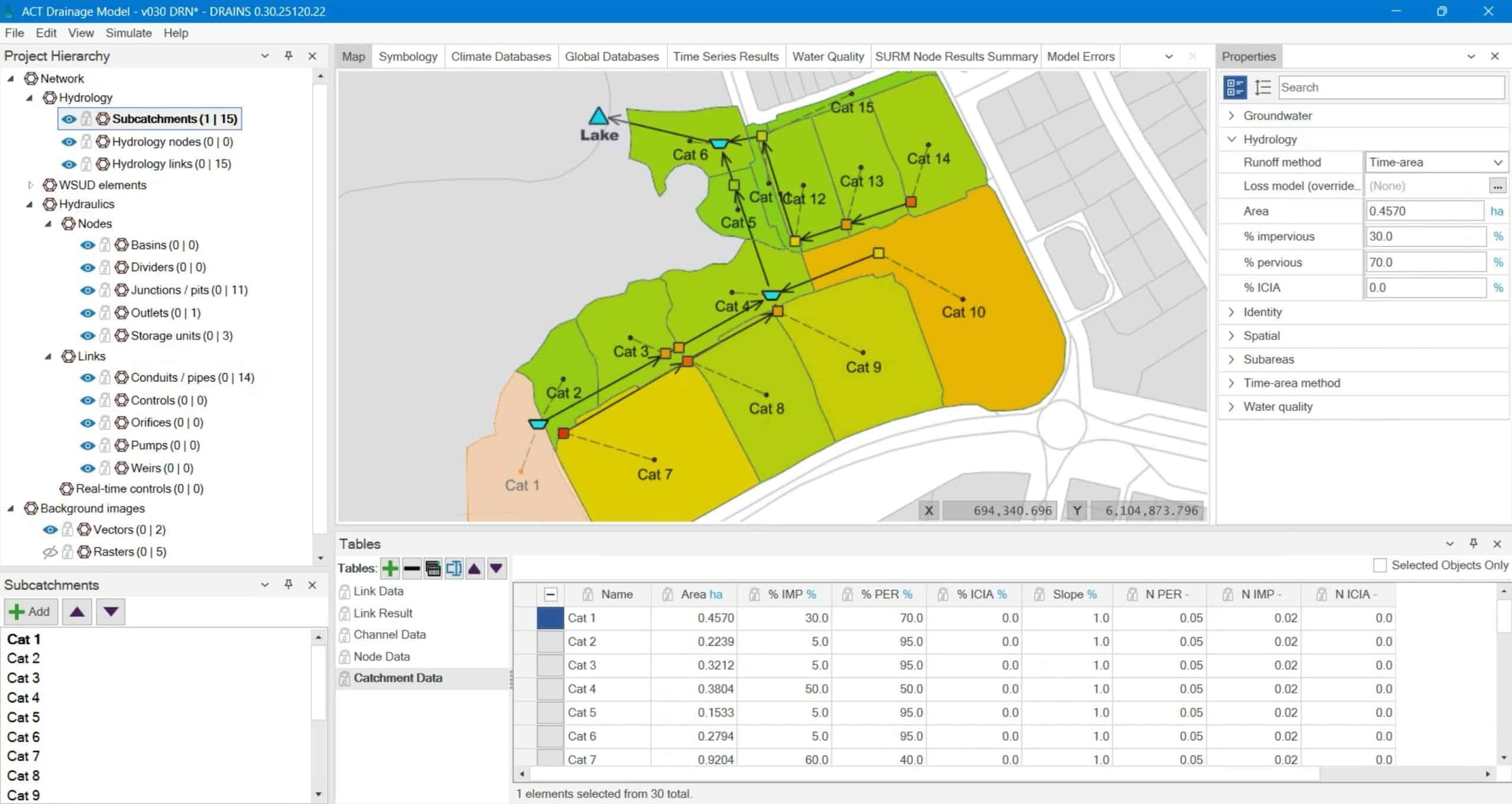
Hydrology
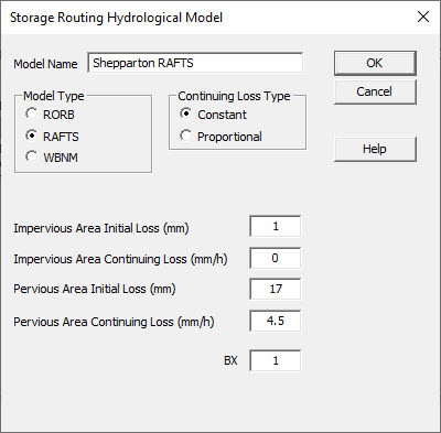
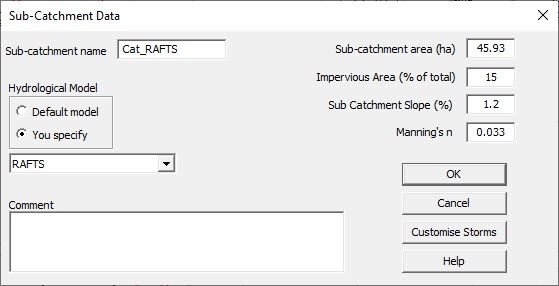
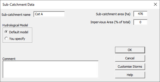
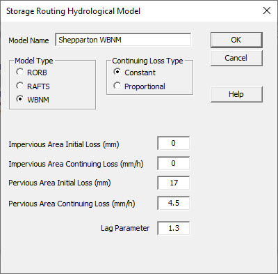
Use IL-CL (the AR&R preferred model), Horton ILSAX, Rational & Extended Rational Method models, and a Storage Network Routing Module that includes RORB, RAFTS and WBNM.
Hydraulics
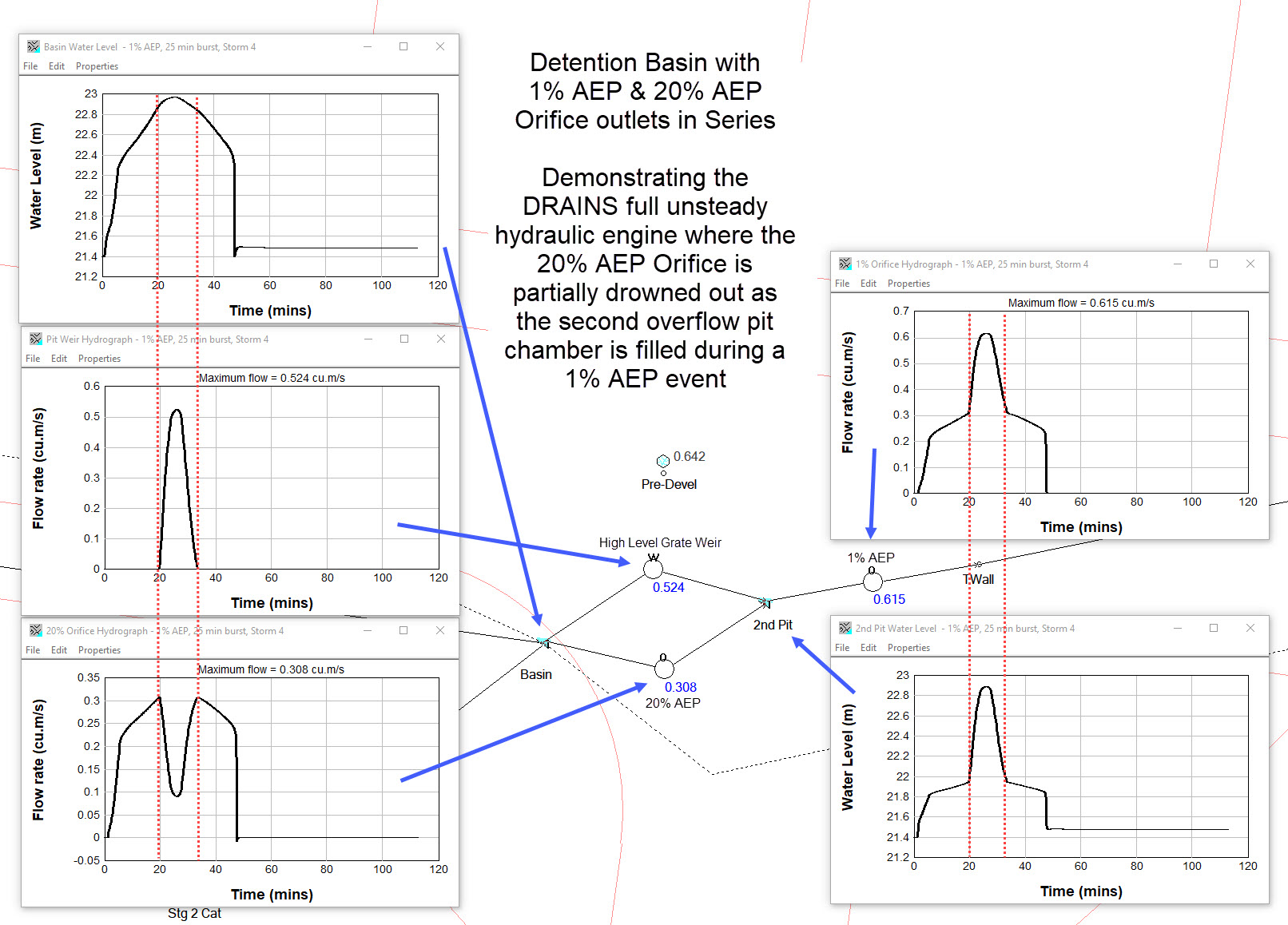
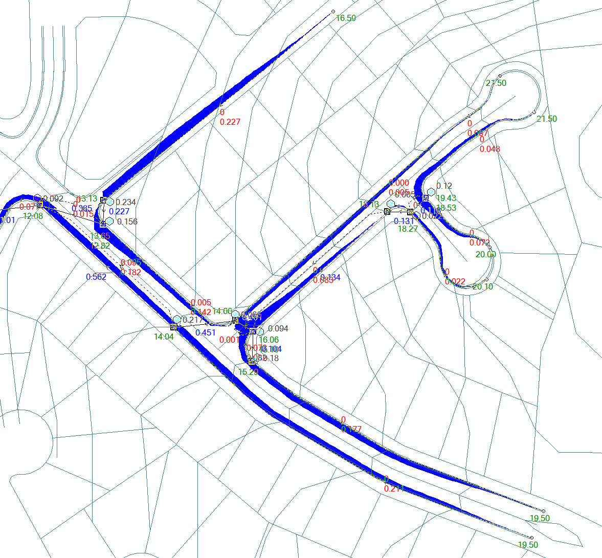
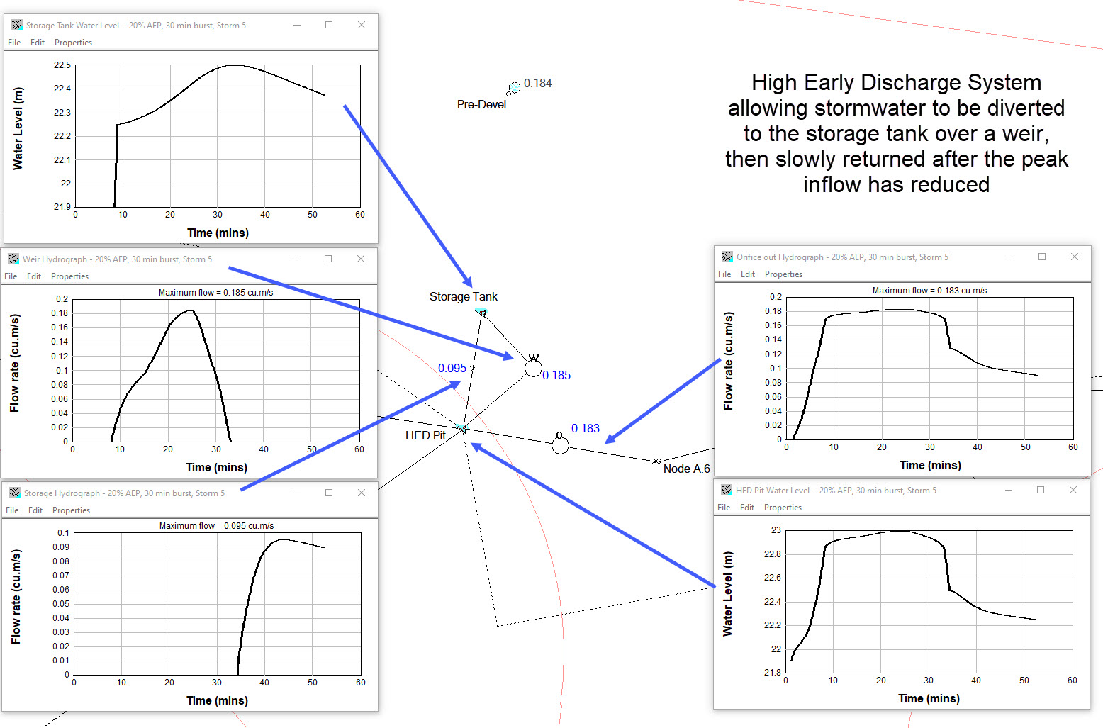
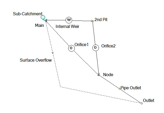
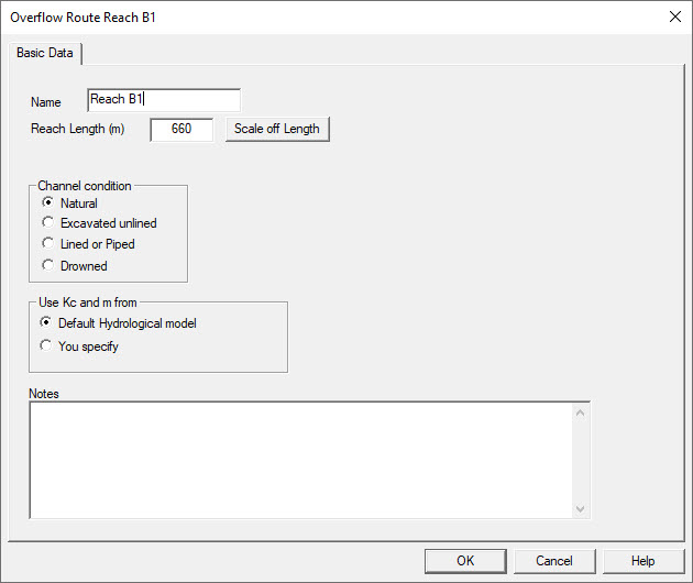
Solve the full unsteady flow equations, which is useful for analysing complex surface flooding situations where storage or backwater effects occur in overflow routes, or when splitting surface flows in multiple directions.
DRAINS Versions
We offer multiple versions of DRAINS.
DRAINS Demo, DRAINS and DRAINS Viewer all include the Australian Rainfall and Runoffs’ (AR&R) Initial Loss – Continuing Loss (IL-CL), Horton (ILSAX) and Rational & Extended Rational Method hydrological models, and are capable of analysing AR&R temporal patterns and design procedures.
The Full Unsteady Hydraulic Model, Storage Network Routing Models (RORB, RAFTS & WBNM hydrological models) and the GIS Module are also included.
Demo
The demo version of DRAINS (available to download here) is fully functional software, except that it is limited to a maximum of five pipes or channels, one irregular channel and limited to viewing existing detention basin data only.Â
DRAINS
DRAINS solves the full unsteady flow equations in pipes, channels and overflow routes. DRAINS is available in multiple licensing options.
- Solving the full unsteady flow equations is useful for analysing complex surface flooding situations where storage or backwater effects occur in overflow routes, or when splitting surface flows in multiple directions via multiple outgoing overflow routes.
- Pumps, weirs and orifices can be modelled as separate objects allowing for complex arrangements (e.g. multi-level orifice outlets from detention basins or pit diversion chambers, or overland flow diversions across the crown of a road).
- It also includes a flood mapping capability.
DRAINS Viewer
The free DRAINS Viewer allows anyone to open DRAINS files and inspect the model structure, inputs and results. The Viewer operates in the same way as DRAINS, but does not allow models to be altered or run.
- If a DRAINS .drn file contains stored results, these can also be viewed, and exported to spreadsheets.
- The purpose of the Viewer is to make checking or reviewing of DRAINS models easier, either within an organisation, or between organisations such as a consultant preparing a model and a Council reviewing this.
- The Viewer can be freely distributed by DRAINS users to other organisations.
- The Viewer will need to be periodically updated when the DRAINS .drn format alters, otherwise it will not be able to view files created with the latest version of DRAINS.
DRAINS Licensing
DRAINS is available in various licences and options.
Here are some things to consider when planning to purchase a new licence.
Number of Links
Most licences are available in 5, 20, 50 or Unlimited Links.
Subscriptions
Simple recurring payments. Select 30-Day or Annual Terms.
Perpetual Licence
Access DRAINS without a USB on registered devices.
NO LONGER AVAILABLE
USB Licence
Access DRAINS with a USB on any device of your choice.
Network
Shared access between PCs via a Subscription or Perpetual Licence.
All Features
All new licences include the full suite of current DRAINS functionality.
Included Features
These additional features are included with all DRAINS licences.
- Storage Network Routing Module
- GIS Data Exchange
- Rational + Extended Rational Method Hydrological Methods
Storage Network Routing
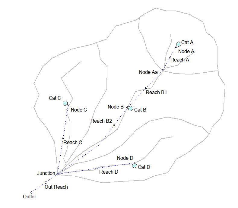
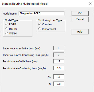
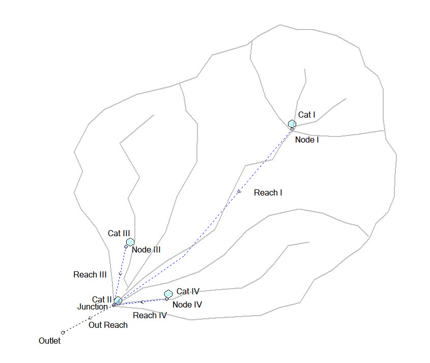
The Storage Network Routing feature adds the RORB, RAFTS and WBNM storage routing hydrological models, useful when modelling large urban or rural sub-catchment areas where estimating the time of concentration with time area routing might be difficult.
DRAINS RAFTS does not rely on XP Rafts and is not affected by the discontinuation of XP Rafts by Innovyze.
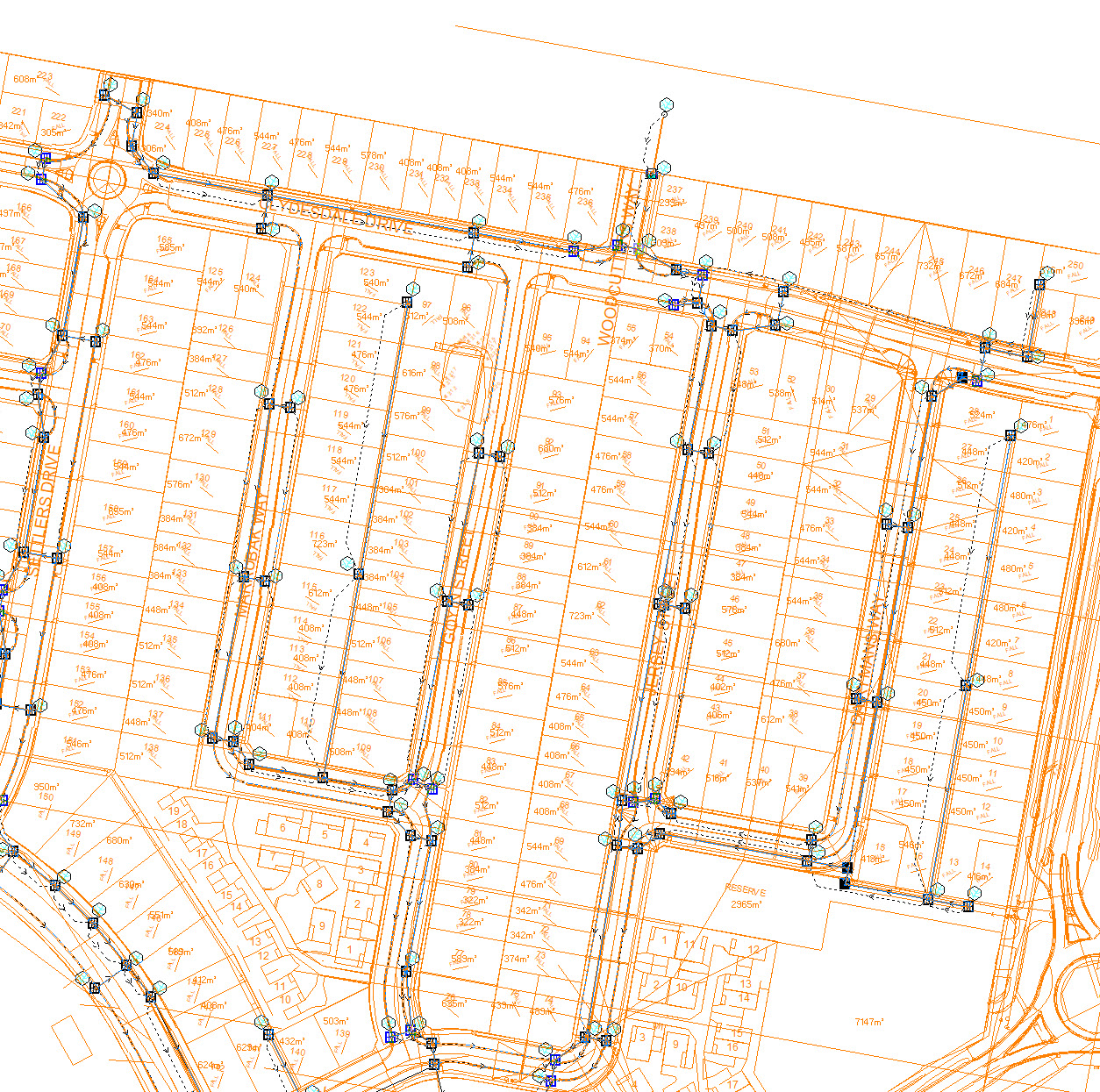
GIS Data Exchange
GIS Data Exchange is useful where you need to interface with GIS systems that support ESRI shapefiles or Mapinfo MID/MIF files. This allows transfer of data and results between DRAINS and GIS.
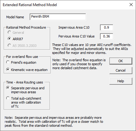
Rational + Extended Rational Hydrological Methods
The Rational + Extended Rational Hydrological Methods add the ability to model the rational method procedures with ARR87, ARR2019 and AS3500.3.
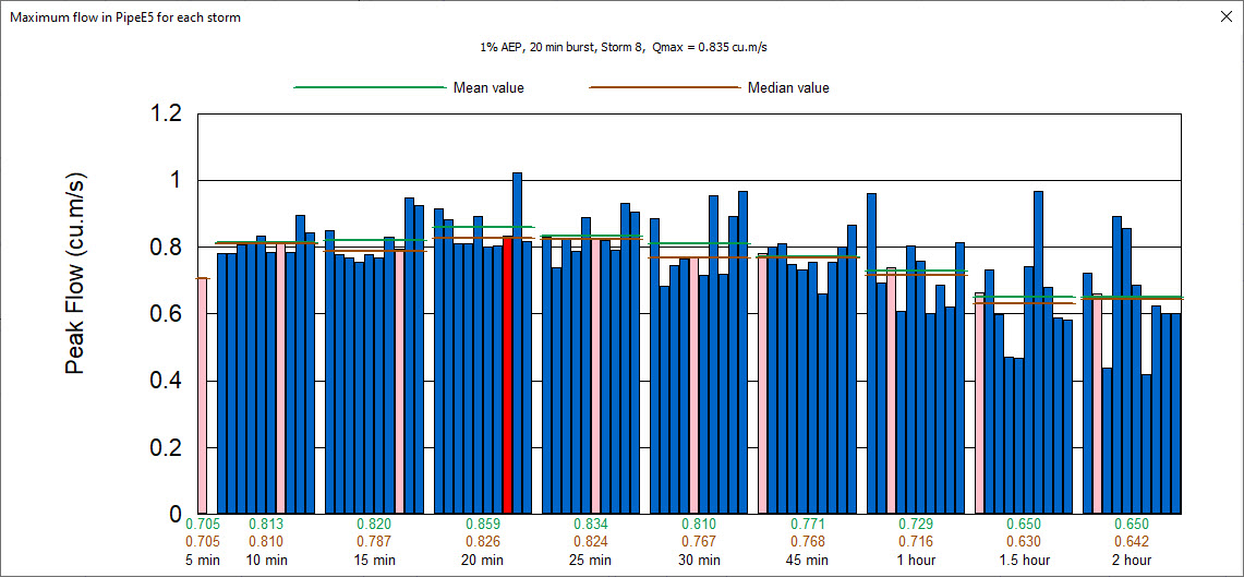
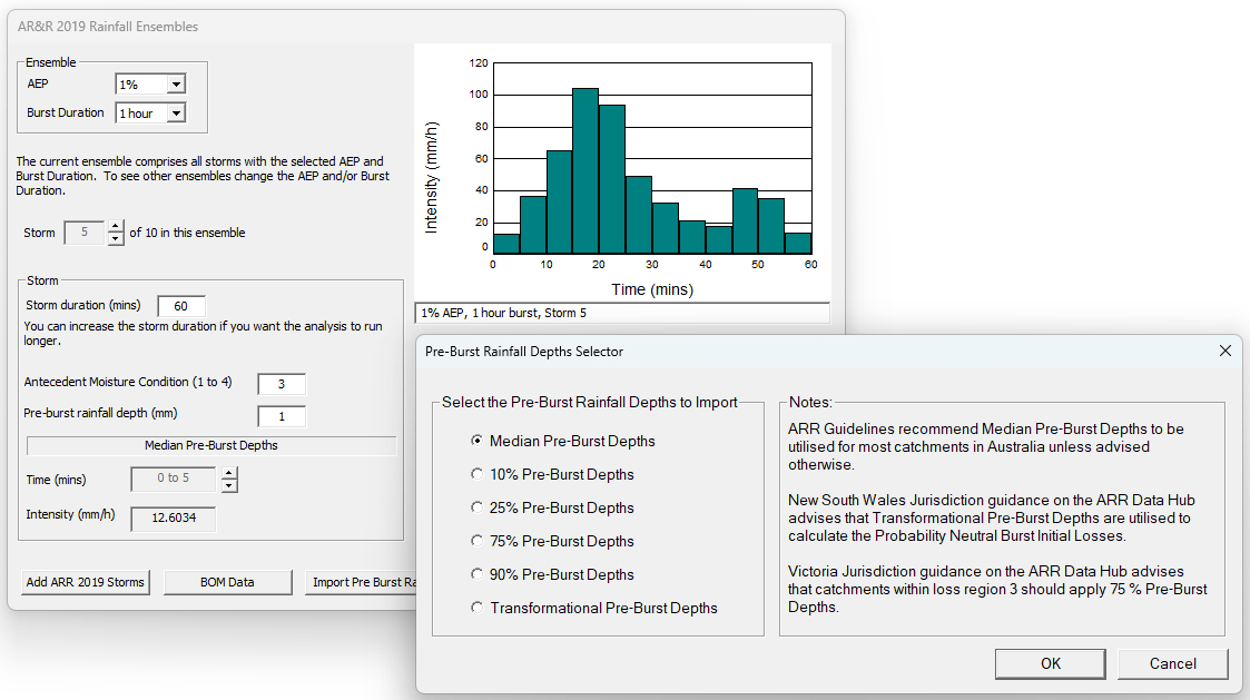
The Extended Rational Method allows users to produce hydrographs to improve detention basin analysis and utilise the full unsteady hydraulic model. This is achieved by including temporal patterns as part of the analysis and including the ability to model ensembles of storms from ARR2019.
Support, at your fingertips.
NEW
Knowledgebase
Quick answers and guidance, now online. Explore our revamped, fully-searchable knowledgebase to resolve your DRAINS software issues quickly. Hundreds of articles and FAQs available.
Software Support
Submit an online ticket for installation, licensing, hydrology, data issues, and more. Get priority support with an active subscription or Maintenance plan.
Model Consultation
Need more than just software support? Book a 1-on-1 online consultation for your model in DRAINS. Instant bookings are available with a senior specialist engineer.
Recent News

New version of DRAINS released (v2025.01)
New version of DRAINS released (v2025.01)

The Future of DRAINS is Coming
The Future of DRAINS is Coming

Missed the ARR Webinar? Watch the recording now.
Missed the ARR Webinar? Watch the recording now.

Shaping Tomorrow’s Engineers with UTS
Shaping Tomorrow’s Engineers with UTS